
3D Laser Scanning Surveys
Accurate 3D data for design offices, architects, contractors and plant operators across the UK
Need an external scanning partner for a large project, or a reliable as-built record before work begins? A 3D laser scanning survey captures your site and turns it into the point cloud, CAD or BIM data your team needs. Our 3D laser scanning services cover everything from control network to final model – whether your brief calls it a laser scanning survey, a 3D survey or a measured survey.
For design and engineering teams
Your team is at capacity, or you need a dependable starting point for a refurbishment or retrofit. We survey the site and deliver registered data in your formats and coordinate system – or take on the modelling as well, so your engineers can focus on design.
Prefer to model in-house? We’ll deliver a point cloud survey ready for your software – or take the project all the way through scan to BIM.
For building and plant owners
You need an accurate record of what is actually there before an upgrade, a fit-out or a maintenance programme. We survey, model and give your whole team access to the data in the browser – tied to a control network, so future surveys fit the same coordinate system.
Running an industrial site? See our approach to industrial laser scanning and digital plant projects, with data shared across your team in WebPano.
CHOOSE YOUR DELIVERABLES
cleaned, registered scan data in E57, RCP, POD, LFM and more
floor plans, sections and elevations
realistic surface models for visualisation and analysis
lightweight, fully editable geometry
Revit and ArchiCAD models at the level of detail you need
intelligent models for AVEVA and other plant design software
scaled, measurable images of facades and floors
360° panoramas, measurements and models in the browser for your whole team
Not sure which deliverables you need? Tell us about your site and we’ll recommend the right scope.
CERTIFIED QUALITY AND SAFETY:
TSA membership
TSA is the trade body for commercial survey companies

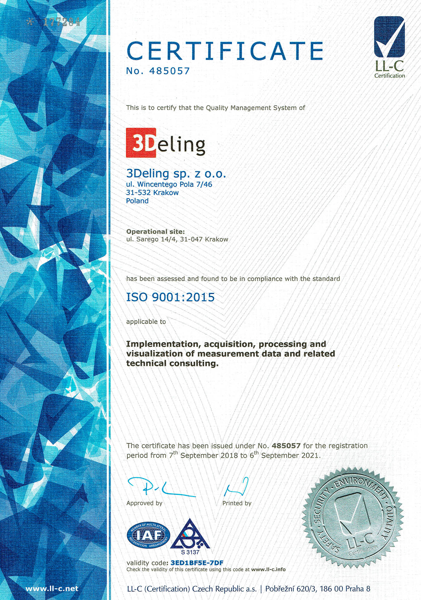
ISO 9001:2015
Our Quality Management System is ISO 9001:2015 certified
SCC* certified
We meet SCC* safety and risk-management requirements for contractors on industrial sites – certified by DNV.

Selected UK projects
Drone Survey of a Larger Rural Estate
urban planning
Drone Survey of a Larger Rural Estate
Central London mansion – BIM model
Central London mansion – BIM model
Manchester Library
Manchester Library
Northern England chemical plant
northern uk
Northern England chemical plant
Working in London? Our London team carries out measured building surveys across Greater London → Measured building surveys in London
WHAT OUR CLIENTS SAY
D2R SURVEY LTD (Great Britain) - The University of Manchester - Library
D2R Survey has collaborated with 3Deling on 3D scanning and Revit modelling projects since 2011, and we have been completely satisfied with the resulting scan data and models in all cases. Our most notable project was the 3D scanning and modelling of The University of Manchester Library, a UK listed heritage site — I have no hesitation in recommending 3Deling.
ISG INTERIOREXTERIOR PLC (London) - Princeton House, High Holborn
3Deling provided the surveying service for our project at Princeton House on High Holborn in London. Throughout our dealings with 3Deling they proved to be helpful, reliable and professional — we would definitely consider them for future work.
Our laser scanning process
Control network
We establish a control network with total station and GNSS observations, giving all scan data a reliable reference to your project's coordinate system. By default we work in a local site grid, which design software handles best, and can transform to the national grid on request. The same control points can later be used to set out new work on site.
Data capture
Our teams scan the site from multiple positions with Leica RTC360, Z+F Imager and Riegl terrestrial scanners, using RTK drones for roofs and large sites, to ensure full coverage with no gaps in the data.
Scan registration
Scans are registered into a single point cloud in Processor, our in-house software, tested on projects with over 5,000 individual scan positions. Combining target-based, feature-based and cloud-to-cloud registration prevents errors from accumulating on long installations.
Quality assurance
Every project includes a registration accuracy report and a QC report with sections through the point cloud.
Modelling and documentation
The registered point cloud is turned into your deliverable: CAD, BIM, plant design models or 2D drawings.
Want to know more? See how we set up a control network for laser scanning and how our scan registration service handles projects with thousands of scan positions.
Why clients choose 3Deling
- Almost 20 years of experience – from offshore oil and gas platforms and process plants to architecture and listed heritage buildings, backed by client references.
- Certified quality – we work to an ISO 9001:2015 certified quality management system, and every project comes with registration and QC reports, so you can check the data yourself.
- The whole process under one roof – few companies can take a project from site to browser in-house. We scan, register and model your data, then publish it in WebPano, our own browser-based platform, where your whole team can view, measure and comment – no point cloud software needed.
- Every deliverable from one scan – registered point clouds, 2D drawings, 3D CAD, mesh and BIM models, plant design models and orthophotos, all produced by our own team of around 70 people. You can start with the point cloud and order more later, without going back to site.
Where we work
- Industry and energy – power stations, process plants and oil and gas installations
- Architecture and construction – measured building surveys, scan to BIM, refurbishment and new build
- Offshore – rigs and vessels, surveyed by OPITO and NOGEPA-accredited teams
- Heritage – listed and historic buildings
- Urban planning – large-area surveys and Rights of Light analysis
- Digital plant – asset digitisation for operations and maintenance
Tell us about your site
Send us the site address and what you need – we’ll come back with a scope and a free quote within a few working hours (Mon–Fri, 9:00–17:00 CET).
FAQ
What is a 3D laser scanning survey?
A non-contact survey that captures millions of measurement points across a site every second. The result is a point cloud survey: a dense, accurate 3D record of the as-built environment, which can be turned into drawings, CAD or BIM models. It is a different (and often complementary) technique to photogrammetry
Is 3D laser scanning the same as a measured building survey?
Largely, yes. A measured building survey is the traditional term for capturing accurate dimensional data from an existing building; 3D laser scanning is the modern method most surveyors now use to deliver it. Topographical surveys are usually measured with GNSS and total stations, often combined with laser scanning or drone data for buildings and complex features.
How accurate is 3D laser scanning?
Accuracy depends on the scanner, site conditions and the control network. With target-based registration tied to a control network, a global accuracy of 2–5 mm is achievable under favourable conditions – verified in the registration and QC reports you receive. More on point cloud registration accuracy.
Does my as-built model need to be millimetre-accurate?
Not necessarily, and often not desirably. Scanner accuracy and model accuracy are two different things, and over-specifying precision can produce models that are more expensive and harder to use, not better.
How many scans do I need for reliable data?
It depends on the complexity and size of the site more than on any fixed rule. Good coverage from many well-planned positions matters more than maximum resolution – it means fewer gaps and faster modelling.
How long does a laser scanning project take?
Timescales depend on site size, complexity and the deliverables required. Get in touch for a project-specific estimate.
How much does 3D laser scanning cost?
Pricing depends on site size, complexity, access and the deliverables you need. Read how 3D scanning costs are determined, or ask us for a free quote.
Do you work across the UK?
Yes. We deliver 3D laser scanning services across the UK and worldwide, with a dedicated team for measured building surveys in London.
Ready to discuss your survey?
Send us the site address and what you need – we’ll come back with a scope and a free quote within a few working hours (Mon–Fri, 9:00–17:00 CET).