2D CAD Level of Detail (LOD)
DEFINED FOR EVERY 2D CAD PROJECT AT THE QUOTATION STAGE
2D architectural drawings produced from point clouds can be both highly accurate and highly detailed. The limit for both is the accuracy that can be achieved within the point cloud itself. For most architectural drawings, the accuracy bands associated with traditional 1:50 and 1:100 plot scales are more than adequate.
The 2D CAD level of detail should be chosen based on the intended use of the drawings. Level of detail and accuracy directly affect the time needed to produce the drawings, and therefore both cost and delivery time, so we agree them at the quotation stage.
Below we outline three levels of detail for 2D deliverables. Treat them as a starting point: any element can be added or removed, across the whole project or in a specific area. Provided the building has been fully scanned, information can also be added later as the project progresses. For example, a simple floor plan can be supplemented with sanitary fittings, partitions or MEP equipment, without changing its original accuracy.
Level 1 – Basic Detail
Basic outline information suitable for space planning, lease plans, fire drawings or feasibility studies
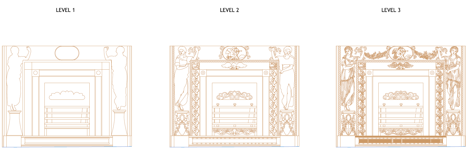
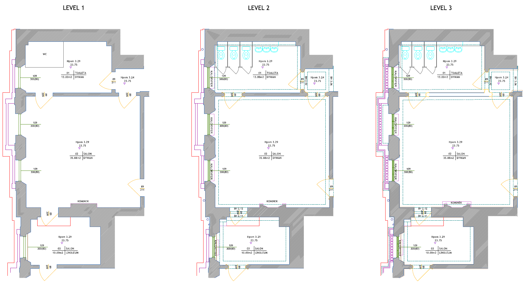
Main building structure and structural elements, simplified window frames, door swings, staircases, balconies, partitions and fireplaces in outline
Major floor levels and ceiling heights

Level 2 – Standard Detail
Typically used for record drawings, refurbishment and feasibility surveys
Everything in Level 1, plus simplified railings, main services, inspection covers and gullies, ceiling details in outline and sanitary fittings as symbols
Floor levels, ceiling heights, beams, arches, door and window heights
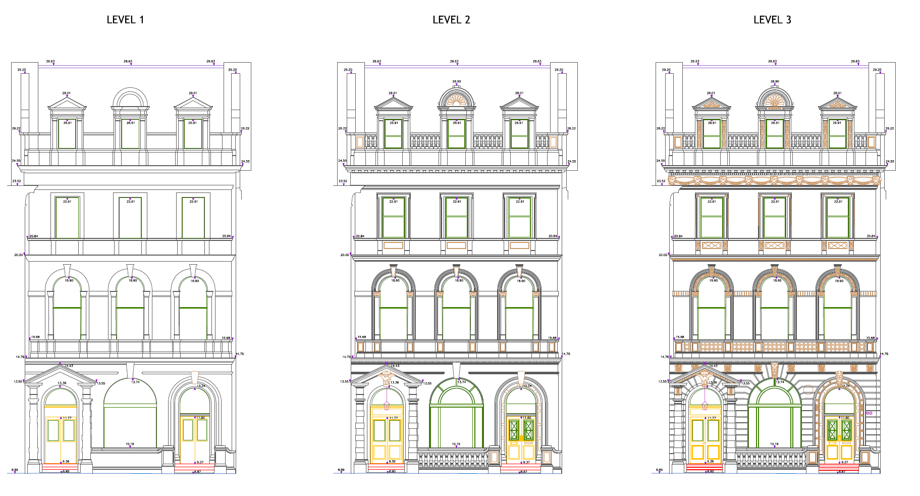
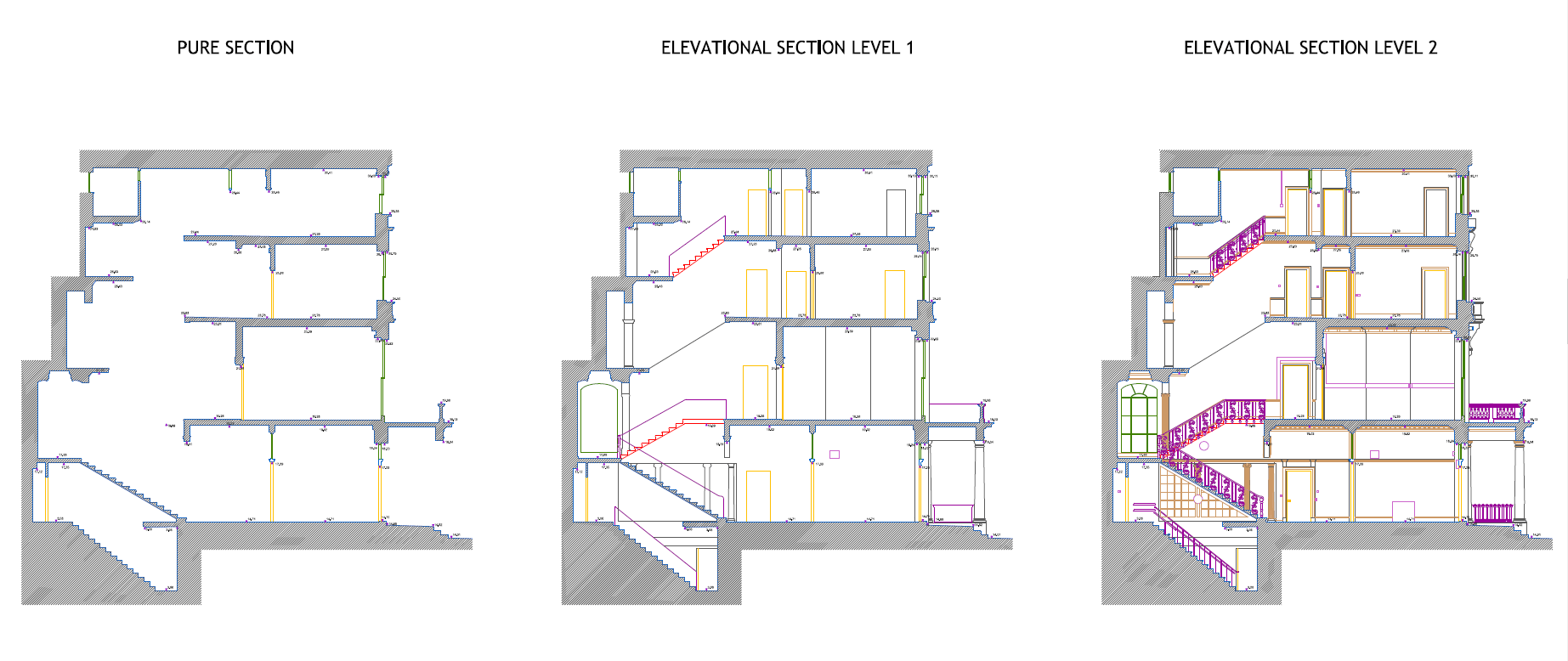
Elevations show enhanced architectural features; sections may include basic elevation detail as an option
Level 3 – High Detail
Typically used for refurbishment, structural alterations and heritage recording
Floor levels, height information fixtures and fittings, ceiling details. May also include a greater degree of services information.
Elevations will show all architectural features and details. Sections may include detailed elevational information as an option. Could be used for refurbishment, structural alterations, heritage recording.
Drawing scale and accuracy bands
Scale and level of detail are chosen separately: you can order, for example, Level 2 drawings at 1:100. The selected scale determines line accuracy, the generalisation of elements and the size of annotations. We follow the accuracy bands set out in the RICS guidance Measured surveys of land, buildings and utilities:
- Band D – ±10 mm, 1:50: floor and reflected ceiling plans, external and internal elevations, cross sections, sectional elevations
- Band E – ±25 mm, 1:100: floor and roof plans, reflected ceiling plans, roof-line elevations, external and internal elevations, sections
- Band F – ±50 mm, 1:200: 2D and 3D topographical surveys, elevations for Rights of Light analysis.
If your project needs a larger scale, such as 1:20, let us know in the form.
What drawings can we produce?
Floor plans, roof plans, reflected ceiling plans, external and internal elevations, cross sections, sectional elevations and topographical surveys. We work to our own CAD layer standard (included in the form) or to your layers, templates and language requirements.
Not sure which level you need?
More detail isn’t always better: it can multiply drawing costs without adding real value. Learn how to define the right LOD and accuracy for your project →
DOCUMENTS TO DOWNLOAD:
Level of detail for other deliverables
Need a different type of deliverable? See how we define level of detail for:
SAMPLES:
Level of Detail for FLOOR PLANS:
Level of detail for ELEVATIONS:
Level of detail for SECTIONS:
Level of detail for CEILING PLANS:
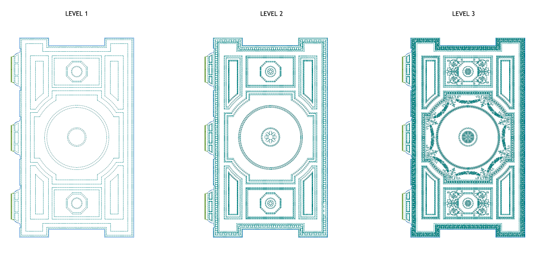
Level of detail for DECORATIVE ELEMENTS: